Last weekend we jumped in the car for our first tour of Scotland! Leaving early in the morning we headed NW of Glasgow towards Loch Lomond, only a short drive away..
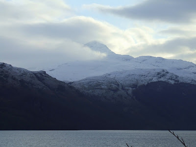
 Our first loch sighting! This is the southern end of Loch Lomond, as seen from the shores of Balloch Castle..
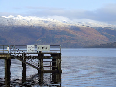
 A little further up the western bank of Loch Lomond we stopped at the tiny village of Luss. Some of the cottages as seen from the pier..
 Typical street view in Luss. They're hills in the background - not mountains, a testament to how low the snow falls around here!..
 Ben Lomond, the most southerly munro (mountain over 3000ft / 914 metres) in Scotland - topping out at 3200ft (974 metres)..
 After driving a little further north we began to climb into the foothills of the Scottish Highlands. This mountain was amazing! As you came around a corner it loomed straight out in front of you, curving it's way up at an amazing angle and resembling a volcano. Known as Beinn Dorain it's another munro, measuring 3530ft or 107
 Once through the foothills we arrived on Rannoch Moor, usually a boggy plateau during the drier months, but on this day it was a sea of snow! (and Red Deer stags)..
 Looking south from a roadside viewpoint over the 'Bridge of Orchy' area. On the left is the munro Bienn An Dothaidh and behind it is Beinn Dorain. The water in the foreground is Loch Tulla. The Bridge of Orchy was built in 1751 as part of a government program to pacify the wild highland clans..
How's this for a busking performance! Bagpiper on Rannoch Moor - it doesn't get much more Scottish than this!..
 Meall a' Bhiuridh (1108 metres) as seen from the highway. Just visible in this photo are the chairlift towers (at right) heading up to the first ridge (lights) and then up to the summit. This is the Glencoe Ski Centre!..
 Buachaille Mor (better known as The Buachaille) next to the Glencoe Ski Centre. This is another amazing mountain - it has the perfect, stereotypical mountain shape and rises so sharply from the floor of the glen..
 After passing through Glencoe and having lunch we continued driving SW along the coast of Loch Linnhe. This pic is looking over Shauna Island to the hills of the Kingairloch region. This loch is almost at sea level, again showing how low the snow falls..
 Further down the coast we stopped at Dunbeg to check out a castle on a short outcrop of land. This is the view from the carpark - looking over the harbour to the hills beyond..
 This is Dunstaffnagle Castle. Built on top of a rocky outcrop (in 1260!) it is now part of the National Trust of Scotland's treasure trove. It was captured by Robert the Bruce during the Wars of Independan
 Further south we arrived at Oban. A coastal town and departure point for many of the islands and outer isles in the area. The town itself sits on the banks of the Firth of Lorn..


No comments:
Post a Comment